Gone Walkabout...

This blog was going to be about my travels and impressions I had from them. But my attention span went walkabout. And like with any good walkabout I discovered unexpected things. I invite you to come explore with me...


You can contact me at teri-gonewalkabout@live.com

Showing posts with label Clarksville TN Flood. Show all posts

Saturday, May 15, 2010

Flood Clean Up in Clarksville, TN

We left for MO on the 6th, as the flood waters were still coming down. Riverside Drive (where many of the earlier photos I posted were taken) reopened to traffic on Sunday night.


We drove downtown a couple days ago to see what had happened to our city. It was amazing.


Himself pointing to the crest levels of Clarksville’s two great floods. His top hand is pointing to the 1937 mark and his bottom hand is pointing to the high water mark of 2010.

When we were downtown on the 3rd, the water was just touching the tires of this truck. Himself is showing the high water mark.

High water mark on a Riverside Drive building.

A flooded bank doing business out of this RV.

High water marks on a local restaurant.

Cleaning up.

Washed away river bank.

Hardware City was hard hit. This is the type of store that was CRAMMED full of every sort of thing you could ever want. They are asking for volunteers to help empty the store and sort the merchandise.

Himself and I will be going down next week to help

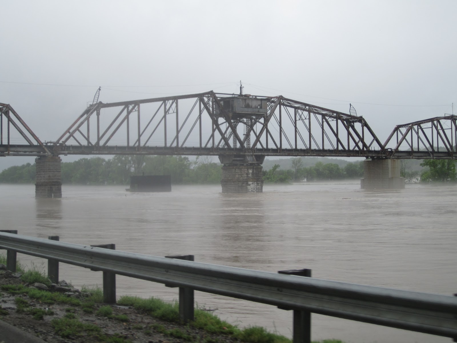
The river crested above the dark band on the bridge support.

High water mark on a truck at the Two Rivers office complex. Himself said it was about 9’. Parked next to it was someone’s Jaguar.

Restaurant cleaning out at the complex.

High water mark is just below the red band near the top of the ATM.

Coin and jewelry shop cleaning up.

Shoney’s hauling out their ruined furniture.

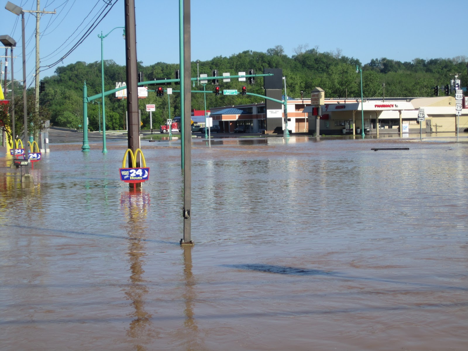
Andy’s Pharmacy doing business out of the building’s garage while they clean up the shop portion.

Everyone is trying to help with the clean up. Here is a farmer’s water tank being used to wash out a parking lot.

And the fire department is using one of their tankers.

Monday, May 3, 2010

Monday photos of the Clarksville flooding.

We got up early today and went downtown to see what had happened overnight.  UF-DA!!!  Major flooding and the water was still rising!!

Sunday - bridge high water marks

Monday - even higher

Sunday - road near our house (we are on the other side of the creek)

Monday
  
All the rest of the photos are along Riverside Drive between Commerce and N. Second St.
At Main St and Riverside Dr.
 
Looking north from the pedistrian bridge at College St.

And looking south.

Briggs Clothiers.  Thankfully our friend had moved earlier in the year!

Some Midas customers are NOT going to be happy!

Two Rivers office complex from the Sonic parking lot.

Arbys

Hooter's at Two Rivers.

Shoney's on North Second and Riverside.  The flow is from the Red River.

Intersection at Riverside-North 2nd-New Providence-Kraft St.

Hi-Lo on Riverside.

McD's on North Second.  They were moving things out while we were there.

This semi went over to the flooding motels and helped people get their cars moved!

Service bay at a car dealership next to Sonic.

Harbor Freight Tools in the Two Rivers complex.

O'Charlies

New China

Tire shop next to O'Charlie's.  Waste Management was trying to round-up their dumpsters.

Nothing they could do but watch.

River near our house.

Tennessee Flood Outside Our Door

Perhaps you've seen on TV the news of the flooding in middle Tennessee. That's right where we are.

Our home has had about (guessing) 10-12 inches in the last 2 days. While we are on the Cumberland River, we are on the high side of it and look across at the flood plain. So it's been no real problem except for some gullies cut in our driveway. Minor stuff.

Here's an autumn photo of the river as seen from our deck. You can see how high the flood plain is from the river bed. 


And here is the same view with the flooding. That ridge of rock is the top of the bank!  


Here's another view from the other side of the valley from our house. 


 We left for church early to drive thru downtown to see how it was there. This is big turn-bridge on Riverside Drive. It is usually at least 10 feet lower.


And here's a closer shot about 5 hours later. 


Still rising. 


On Riverside Drive looking south at the "smokestacks".  


A car dealership on Riverside. He was moving his cars out of the lot.  


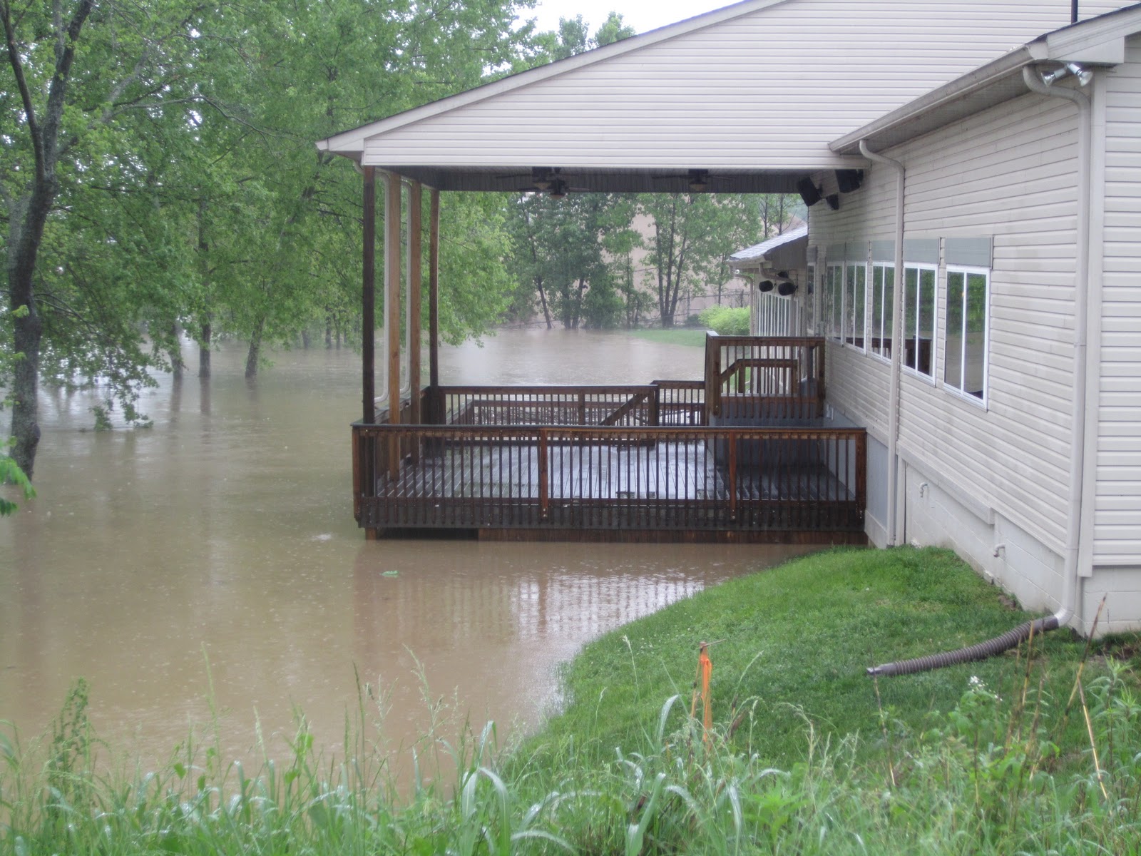
The back of the Riverside Conference Center. Just past it is the Ingram sand lot. The water was already over the bank there and into the property. 


The entrance of the old Fairground/soon to be marina. As we went by there were a group of men huddled up talking and pointing... 


...at their equipment down near the river that would soon be underwater! (Taken from the Zinc Plant bridge). The park was almost completely flooded. 


This is the parking lot in the back of the old Two Rivers mall. When we had gone thru 5 hours earlier the water was just at the edge of the parking lot. Now it is over a full parking row.  


Himself at a popular fishing area on the backside of Clarksville Base on Ft. Campbell. We've never seen the water over the bridge...never mind that far up the road!  


The picnic area of Lake Taal on Ft. Campbell (behind the stables). Check out the logs that had floated in! 


 The park from the top of the Lake Taal spillway. That is normally a nice little creek.


Flood waters tearing over the spillway. 


Not today...